|
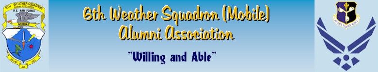
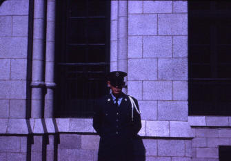 I served in the U.S. Air Force
from 30 Apr 1963 until 29 Apr 1967. I did my basic training at Lackland
AFB in Texas. I then went to Chanute AFB in Rantoul Ill. for tech school.
I was a Weather Equipment repairman which meant that I was an electronics
technician. My tech school consisted of a complete course in electronics
and then an additional eight weeks of specific training on various types
of weather equipment. (32 weeks total) I served in the U.S. Air Force
from 30 Apr 1963 until 29 Apr 1967. I did my basic training at Lackland
AFB in Texas. I then went to Chanute AFB in Rantoul Ill. for tech school.
I was a Weather Equipment repairman which meant that I was an electronics
technician. My tech school consisted of a complete course in electronics
and then an additional eight weeks of specific training on various types
of weather equipment. (32 weeks total)
Counting
Basic training, Tech school, and time spent waiting for my tech school to
begin, I spent almost one year in Air Training Command. (ATC) While at
Chanute, an interesting event happened. One day a friend and I were
walking from the post office to the chow hall and stupidly we were focused
on our mail and not on where we were going. Sure enough a full bird
colonel walked pass us and we did not salute him. Once he passed us we
realized what we had done and we both froze. We stood there waiting for
the ax to fall. After a few seconds nothing happened so we turned around
to take a look see, and he was still walking down the sidewalk. We were
not about to kick a sleeping dog so we beat a hasty retreat into the chow
hall. After that I made sure I was in a safe place before I opened any
mail. 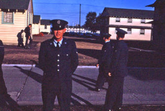
When I finished the electronics portion
of my training, we were given two weeks leave. During this two weeks I
went home to Miami and married Hazel Crews. We then drove back to Rantoul
and spent the winter in Illinois. Quite a shock for us Miami natives.
However, there was no way a newly wed couple was going to freeze; if you
get my meaning.
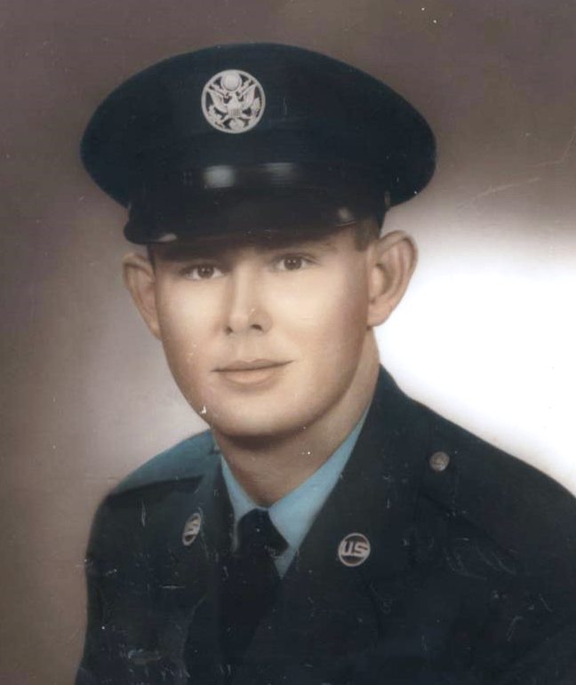
After tech school, I was assigned
to the 6th Weather Squadron (Mobile), at Tinker AFB, in Oklahoma City, OK.
As the name of the unit signifies, this was a mobile weather outfit and we
were always going on temporary duty (TDY) assignments all over the world.
I spent several
months in Cape Cod (Otis AFB) doing a warm fog study. They sent two teams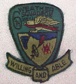 with the intent of us working twelve on and twelve off when there was fog.
The other maintenance tech was from Tennessee and the Air Force reserve
unit from his home town came to Otis for their two week summer training.
Their C130 aircraft went back to pick up paychecks and he asked our NCOIC
for time off to go visit his family. The NCOIC approved it because we had
not had any fog for about a week and none was forecast for the next
several days. They would fly down one morning and fly back the next day.
After they left Tennessee to come back, his father died of a heart attack.
When the plane landed at Otis, he was informed and the plane turned around
and took him back home. At this very time nature stepped in and the fog
rolled in. It hung on for about four days and yours truly had to do double
duty. I stayed at our site for three days grabbing an hour’s sleep here
and there. Tinker finally sent another man to help relive me. When he got
there I went back to the barracks and I think I slept for 24 hours
straight. After that it was back to Tinker for a few months.
with the intent of us working twelve on and twelve off when there was fog.
The other maintenance tech was from Tennessee and the Air Force reserve
unit from his home town came to Otis for their two week summer training.
Their C130 aircraft went back to pick up paychecks and he asked our NCOIC
for time off to go visit his family. The NCOIC approved it because we had
not had any fog for about a week and none was forecast for the next
several days. They would fly down one morning and fly back the next day.
After they left Tennessee to come back, his father died of a heart attack.
When the plane landed at Otis, he was informed and the plane turned around
and took him back home. At this very time nature stepped in and the fog
rolled in. It hung on for about four days and yours truly had to do double
duty. I stayed at our site for three days grabbing an hour’s sleep here
and there. Tinker finally sent another man to help relive me. When he got
there I went back to the barracks and I think I slept for 24 hours
straight. After that it was back to Tinker for a few months.
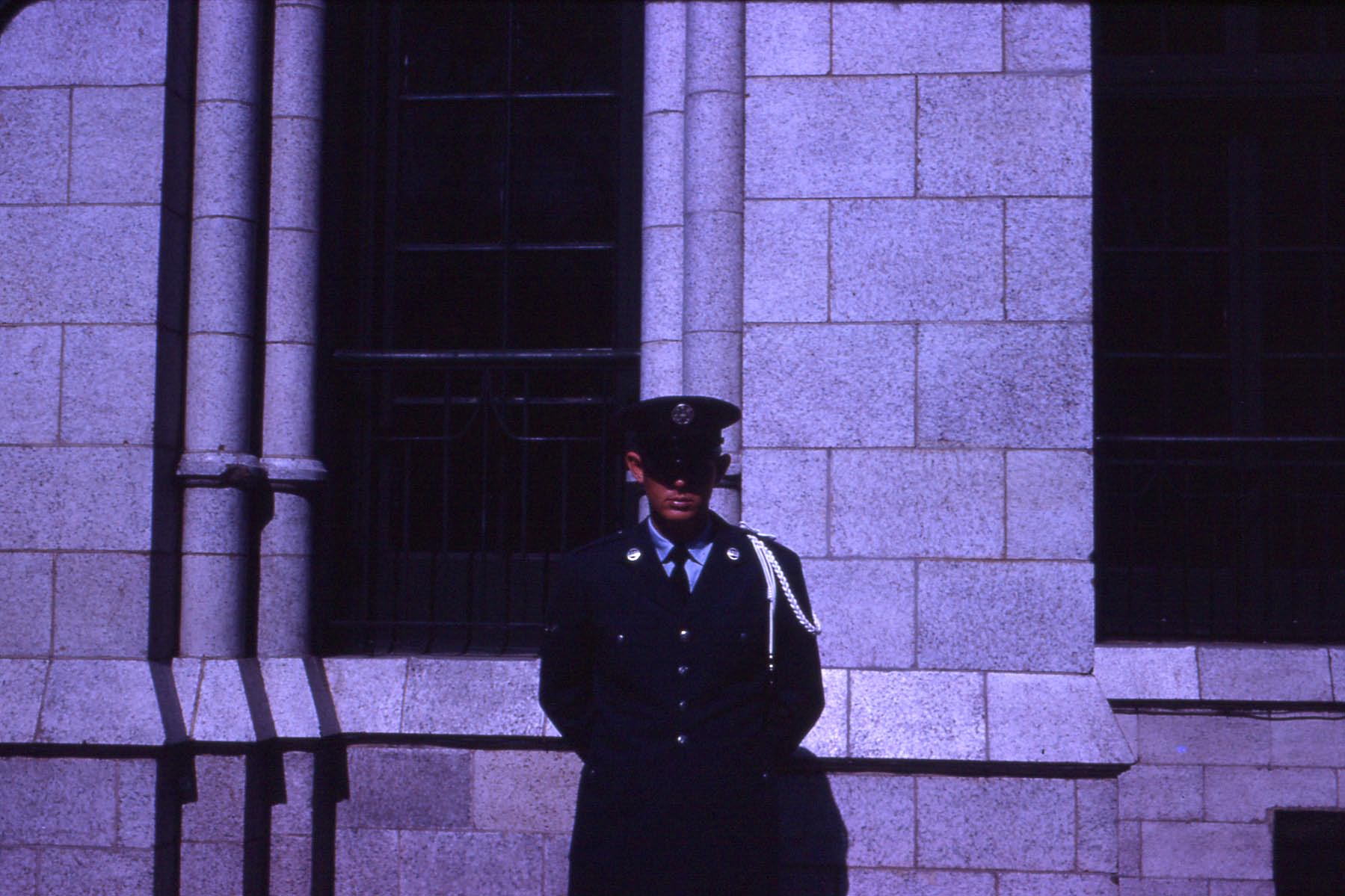
After that I went to the South
Pacific for six months. On my way out, I spent about a week in Honolulu,
Hawaii. While there the guy I was traveling with and I went sight seeing.
The sight seeing of course included the USS Arizona Memorial. The day we
went to the Arizona Memorial, the USS Midway (Aircraft Carrier) was docked
at Pearl Harbor. We went up to
 the Midway, walked up the aft gangway, told
the Officer of the Deck that we were in the Air Force and asked if we
could get a tour of the ship. Obviously two strange dudes in civilian
cloths walking onto the ship caught him off guard. (He was a junior
officer.) He asked for our Air Force ID’s, which we
promptly showed him. He then said that we would have to be in uniform. No
problem we said and went back to Hickam AFB and put on our uniforms. When
we went back I guess he had had time to get some direction from higher up.
Anyway, he told us we would have to find an off duty crewman to show us
around. At this we gave up and left. That night we hooked up with two
sailors while sightseeing in Honolulu (we had rented a car). They happened
to be off the USS Perkins which was a destroyer escort for the USS Midway.
We took them back to their ship and they gave us a tour of the Perkins. I
did finally get to go aboard the USS Midway. In 2013 Hazel and I went to
San Diego to visit Hazel’s sister Doris. The Midway had been
decommissioned and was docked there as a tourist attraction and we went
aboard. the Midway, walked up the aft gangway, told
the Officer of the Deck that we were in the Air Force and asked if we
could get a tour of the ship. Obviously two strange dudes in civilian
cloths walking onto the ship caught him off guard. (He was a junior
officer.) He asked for our Air Force ID’s, which we
promptly showed him. He then said that we would have to be in uniform. No
problem we said and went back to Hickam AFB and put on our uniforms. When
we went back I guess he had had time to get some direction from higher up.
Anyway, he told us we would have to find an off duty crewman to show us
around. At this we gave up and left. That night we hooked up with two
sailors while sightseeing in Honolulu (we had rented a car). They happened
to be off the USS Perkins which was a destroyer escort for the USS Midway.
We took them back to their ship and they gave us a tour of the Perkins. I
did finally get to go aboard the USS Midway. In 2013 Hazel and I went to
San Diego to visit Hazel’s sister Doris. The Midway had been
decommissioned and was docked there as a tourist attraction and we went
aboard.
On my flight to Hawaii, I flew
from Travis AFB to Hickam AFB on an Air Force C54 decked out for passenger
travel. This plane had three seats on each side of the aisle. Needless to
say the seats were very narrow. They also faced the back of the plane. I
don't know how many seats there were but every one of them was taken. The
plane was carrying a plane load of military dependents going to Hawaii. It
was a twelve hour flight from Travis to Hickam and we were feed two box
lunches during the flight. With the narrow seats and crying babies this
has to be one of the most miserable flights I have ever taken.
I then went to the Marshall
Islands. In the Marshall Islands, I was on Majuro, Eniwetok, and Mili
Atolls. I spent most of my time on Mili Island. Mili Island had been a
large Japanese base during WWII. Anytime an American task force would pass
near it, we would shell it or send planes to bomb and strafe but we never
invaded. As a result of the bombing and strafing, there were bomb craters
everywhere. These craters held water and became a prime breeding ground
for mosquitoes. In fact during the mosquito season they were the worst I
have ever seen anywhere including the Everglades. One curious fact was
that they only came out at night. To be exact they came out at sunset and
stayed until sunrise. When the season first hit we didn’t have any
mosquito nets and we were tormented by these little biting blood suckers.
When we slept, we would completely cover ourselves with our blankets to
try and get some relief from them, but as soon as you fell asleep you
would kick the blanket off because of the heat and the skeeters were there
waiting for you. By the way on all of these islands we lived in large
tents we called Aussie tents. They were large square tents with sides that
you could roll up or let down as you saw fit. However being designed for
the dry climate of Australia they were not very water proof. Anyway one
night I couldn’t sleep so I got up to go to the cook tent and get some
coffee. I passed my flashlight over one of the other guy’s cot and there
was a wall of mosquitoes hovering over his cot waiting for him to kick off
his blanket. We even tried putting our cots in the shallow water of the
lagoon because the mosquitoes wouldn’t go over the water. Unfortunately,
if the tide was going out the skeeters followed it and got us. If the tide
was coming in we got soaked. At this same time we couldn’t sleep during
the daytime because of the flies. There were millions of them. They
crawled all over you; your arms, your face, everywhere. There was about a
half hour around sunrise and sunset when the mosquitoes left and the flies
were yet to come.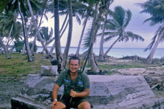
When I first arrived on Mili, I
saw these huge piles of coconut husks on the beach that really destroyed
the beauty of the beach and I wondered why the natives would create such
an unsightly mess. Well when the mosquito season hit I found out why. They
would build small piles of these husks and set them on fire. The husks
don’t really burn, they smolder creating a lot of smoke. They would
position these piles so that the wind would blow the smoke through their
huts. This helped keep the skeeters away. Eniwetok was our net control
station. They are the one we hounded for mosquito nets. It took two to
three weeks before they finally made an air drop to us which included the
nets.
Mili was really an interesting place. As I said earlier it was a Japanese
strong hold during the war. It was also a sub base and there
were still remnants of a dock and small rail road tracks where they would
move torpedoes out to docked subs. This dock area was still littered with
50 caliber ammo and anti-aircraft shells. There were thousands of them
laying everywhere. We were repeatedly warned not to touch anything by our
net control station because of the unstable nature of old ammunition. The
local doctor, actually a highly trained medic, told us a story about the
Japanese occupation. There was a destroyer anchored in the lagoon and the
Americans made an air raid. The planes bombed the destroyer and it sank.
(We could still see the superstructure sticking out of the water. It was
no more that a couple of hundred yards from shore) He said about 150
sailors got off the ship but only 20 made it to shore. The rest were eaten
by sharks.
The natives kept telling us about
a Japanese aircraft hanger in the middle of the island so we asked one of
the natives to show it to us. He took us on what seemed to be a long
circuitous hike through the jungle. Finally he said here we are. All we could see was jungle. He
said look up. Sure enough we could see the super-structure of an old
hanger. A bomb had torn through the top and you could see a hole in the
girders and they were all twisted down and there was a bomb crater
underneath the hole. The natives had salvaged all of the metal sheathing
to build their huts and other buildings. The hanger was typical of the
ones you see here from the 1940’s. It looked like a huge Quonset hut
covered with corrugated sheet metal. We finally started looking around and
we could see a Zero and bomb carts everywhere. The Zero had broken in half
just behind the cockpit. There was also a fuel truck. What struck me about
the fuel truck? It had Firestone tires on it. They were flat and rotten,
but you could still read the Firestone name on them.
the jungle. Finally he said here we are. All we could see was jungle. He
said look up. Sure enough we could see the super-structure of an old
hanger. A bomb had torn through the top and you could see a hole in the
girders and they were all twisted down and there was a bomb crater
underneath the hole. The natives had salvaged all of the metal sheathing
to build their huts and other buildings. The hanger was typical of the
ones you see here from the 1940’s. It looked like a huge Quonset hut
covered with corrugated sheet metal. We finally started looking around and
we could see a Zero and bomb carts everywhere. The Zero had broken in half
just behind the cockpit. There was also a fuel truck. What struck me about
the fuel truck? It had Firestone tires on it. They were flat and rotten,
but you could still read the Firestone name on them.
The Defense Department and the
U.S. Coast and Geodetic Survey Department were re-mapping the whole
Pacific Ocean Area and that is why we were there. They had Army survey
teams scattered all over and my Air Force unit was there to provide
weather data. We actually had three or four weather teams scattered around
providing weather data. They had two Navy ships to transport us around out
there and resupply us. While out there I crossed the equator aboard the
U.S.N.S. Sergeant Curtis F. Shoup while on my way to Arorae. Therefore, I
am a "Trusted Shellback". Both ships had helicopter pads built on them and
that's how we were moved back and forth between the ship and the islands.
It was the Shoup that picked me up at Mili Island and took me to Arorae.
When it got to Mili, It was just after day break and it was a really weird
weather day. The lagoon was as smooth
as glass, and there were almost no waves on the ocean side. Very odd! It
was also very very humid, with not even a hint of wind. Anyway, the
helicopter was having a really tough time picking up all of our equipment.
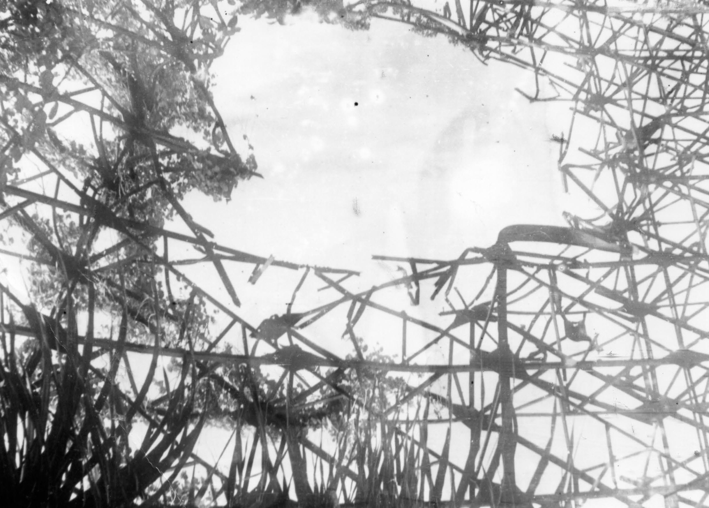
This was our site on Mili. It was
also the narrowest point on the island. The lagoon is on the left and the
ocean is on the
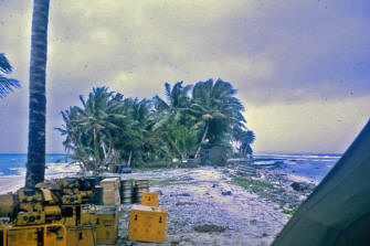 right.
The right foreground is our cook tent. Across the open space you can see
our GMD-1A and the tent holding our recording equipment. Beyond that is
our sleeping tent. Next to the GMD-1A is our power generator, more about
it later. The last thing it picked up was the power generator. It finally
lifted off and started out over the water. Once over the water, the
chopper and generator did a free fall and all of us still on the island
thought it was all over. Luckily, they were able to gain just enough lift
to keep from losing everything. The skids on the bottom of the generator
did hit the water. The chopper could not gain much altitude however. Once
it got out to the ship it had to circle the ship several times to gain
enough altitude to set the generator down on the flight deck. The
helicopter then came back to the island to pick up the 4 or 5 of us still
on the island. They had a real tough time talking us into that chopper. right.
The right foreground is our cook tent. Across the open space you can see
our GMD-1A and the tent holding our recording equipment. Beyond that is
our sleeping tent. Next to the GMD-1A is our power generator, more about
it later. The last thing it picked up was the power generator. It finally
lifted off and started out over the water. Once over the water, the
chopper and generator did a free fall and all of us still on the island
thought it was all over. Luckily, they were able to gain just enough lift
to keep from losing everything. The skids on the bottom of the generator
did hit the water. The chopper could not gain much altitude however. Once
it got out to the ship it had to circle the ship several times to gain
enough altitude to set the generator down on the flight deck. The
helicopter then came back to the island to pick up the 4 or 5 of us still
on the island. They had a real tough time talking us into that chopper.
After the Marshall Islands, my
team was moved to the Gilbert Islands, Arorae Island to be exact. It was
just after day break when we arrived at Arorae. I have always heard tales
about Navy pilots being crazy. Trust me it’s true. When the helicopter
took off to take us to the island he dropped to just above the water and
headed straight for the island with the pedal to the metal. We were below
tree top level. At the last minute he jumped up and went over the island
then dropped back down. He then pulled up to a reasonable altitude and
circled the island. That was a beautiful sight. You could see the lush
green of the island, the sandy beach, and the deep blue of the ocean
beyond the reef gradually changing to a light aqua as the water became
shallower. I can still see those beautiful
red and yellow coral fingers sticking out from the island.
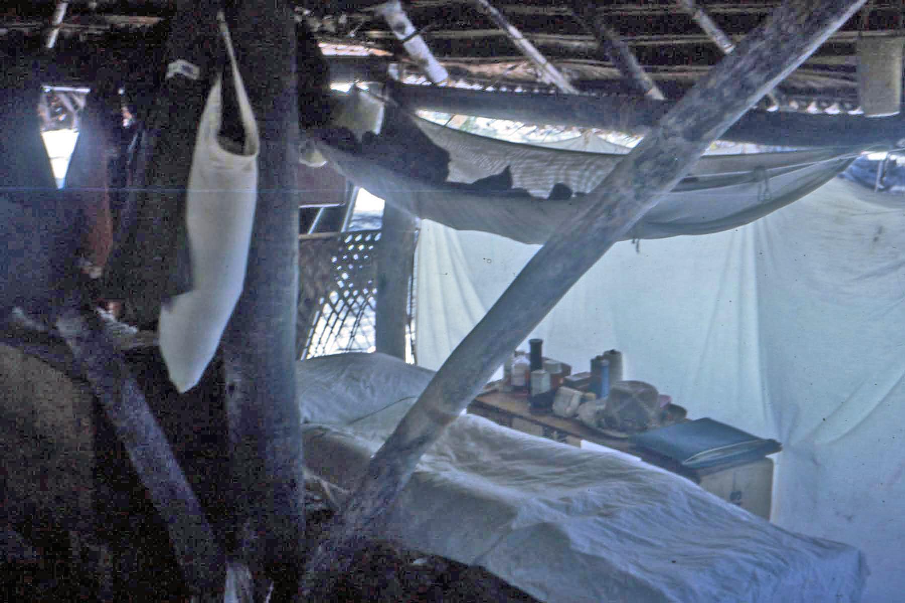
My bunk in our Arorae Hut. Here
we had the natives build us a grass h ut. They used wooden pegs and rope
made from coconut husks to hold everything together. This hut was a lot
more water tight than the Aussie tents. Note the mosquito net above my
cot. After Mili we never let them out of our sight. While on Arorae, I got
caught in a strong undertow while swimming. Luckily one of the native men
was there and pulled me in to shallow water. Had it not been for him, I
guess I would have had only one daughter. ut. They used wooden pegs and rope
made from coconut husks to hold everything together. This hut was a lot
more water tight than the Aussie tents. Note the mosquito net above my
cot. After Mili we never let them out of our sight. While on Arorae, I got
caught in a strong undertow while swimming. Luckily one of the native men
was there and pulled me in to shallow water. Had it not been for him, I
guess I would have had only one daughter.
There was a native village in the
center of the island. However in times past there were two villages on
either end, so they still considered themselves two villages and every
Saturday they would have a dance contest between the two villages. We
liked to go and watch these contests. They would always ask us crazy GI’s
to sing American songs. We were not very good, but they were always very
polite and said they enjoyed our singing. While we were there, their
doctor, (These “Doctors” as they were called, were more like a physician’s
assistant. They could and did perform minor surgeries.) had a baby and
when it was christened, he threw a big party and invited the six of us to
it. (Three Air Force guys and three Army guys.) I have never seen such an
array of food; pork, chicken, and other south sea foods. There were three
lobsters and all kinds of fish and other sea food. And the six of us could
not eat all of it. They had mats spread on the ground and we sat around
the mat to eat. We did have young women sitting behind us with fans to
keep the flies away. By the way, out there the men and women do not eat
together. The men eat first and then the women and children eat after
them. Sometimes we would be invited to eat with them and when we were, we
would always make sure we left enough for the women and children.
While we were on Arorae the copra
ship came to buy their copra. Copra is dried coconut. It is the major cash
crop in the Pacific Island areas. We went aboard the ship and the captain
invited us up to the wheel house. He wanted to know why we were there and
we told him. He then pointed to his chart of the Gilbert Islands and
Arorae Island. He had drawn a dot a little ways away from the printed dot
that was Arorae. He said that the penciled dot was twelve nautical miles
from the printed dot and the horizon from his wheel house is 10 nautical
miles. Therefore, if he went to the printed location he would miss the
island entirely. An object proof for why we were re-mapping the Pacific
Area. By the way, this predated GPS. On my return trip, the ship went by
Tarawa and the helicopter dropped me off. There I met up with a C54 (cargo
version of a DC7) aircraft that flew me back to Eniwetok. We h ad engine
trouble at Tarawa, so the plane left late forcing us to stop at Kwajalein
for the night. The next morning, we left Kwajalein for Eniwetok. I stayed
in Eniwetok for a couple of days then took the "Red Tail" (a North West
Airlines charter flight)
that flew from Hickam AFB to points south. I was at Hickam for one day (I
got in to Hickam about Midnight and left out about 6:00 P.M. the next
day.) then I took a Pan Am charter to Travis AFB in California. From
Travis, I flew by a commercial airline back to Tinker. ad engine
trouble at Tarawa, so the plane left late forcing us to stop at Kwajalein
for the night. The next morning, we left Kwajalein for Eniwetok. I stayed
in Eniwetok for a couple of days then took the "Red Tail" (a North West
Airlines charter flight)
that flew from Hickam AFB to points south. I was at Hickam for one day (I
got in to Hickam about Midnight and left out about 6:00 P.M. the next
day.) then I took a Pan Am charter to Travis AFB in California. From
Travis, I flew by a commercial airline back to Tinker.
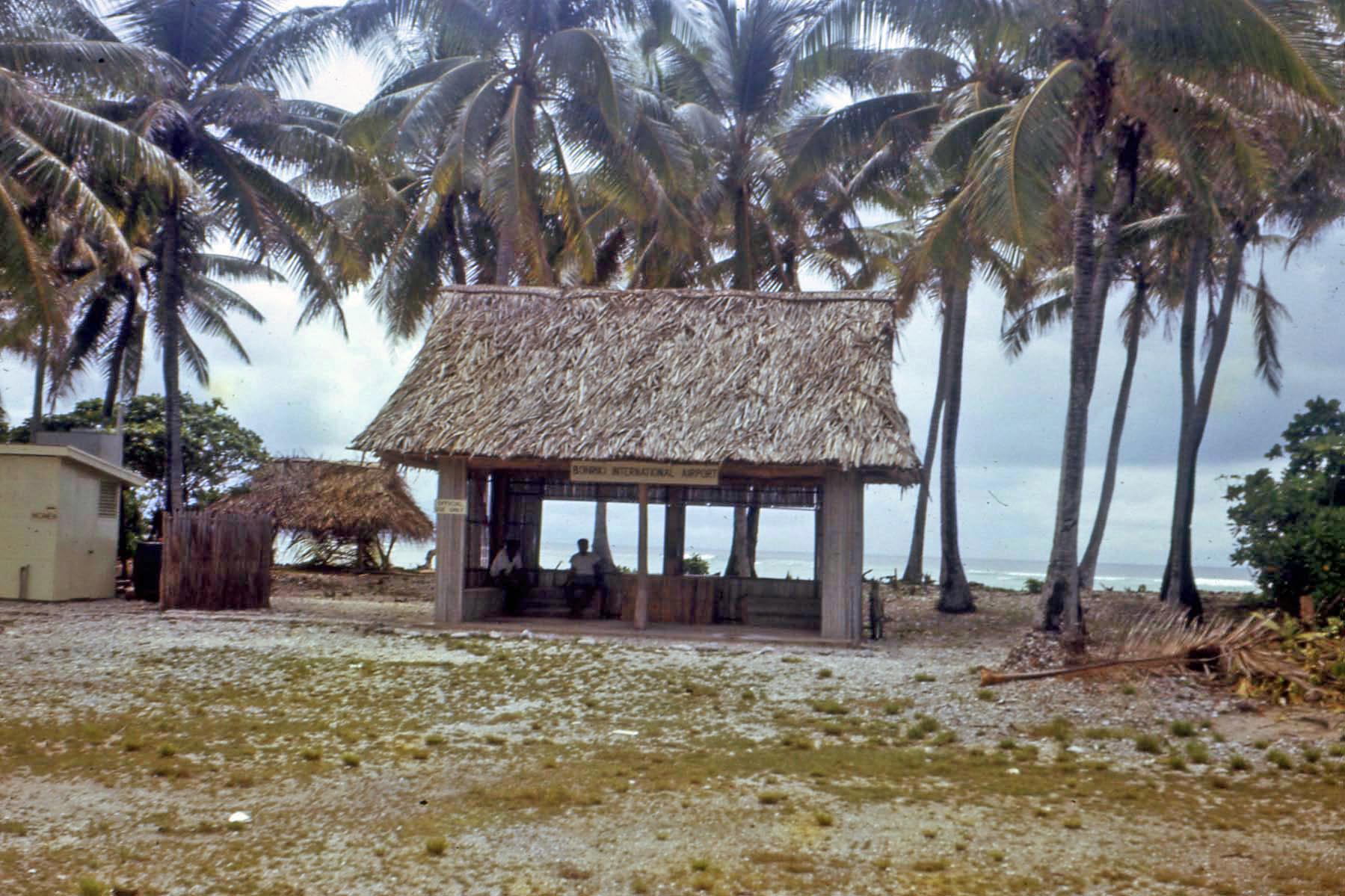
This is Batio International
Airport. I'm not joking. (If you look closely you can see a sign just
under the thatched roof, It says Batio International Airport.) Batio is
one of the islands of the Tarawa Atoll. Batio is actually the island where
the WWII battle of Tarawa took place.
After the South Pacific I again
spent a couple of months at Tinker, and then I was sent to the Alaskan
Aleutian Islands on another TDY. By the way the primary weather equipment
we used was the GMD-1A. It is a radio directional receiver that tracks
weather balloons.
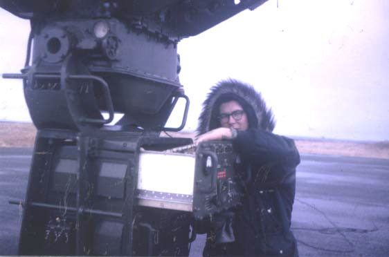
The is the GMD-1A that we tracked
weather balloons with. It is the primary equipment that I worked on. This
picture was taken on Amchitka Island. We were sent to Amchitka which is an
uninhabited
island close to the west end of the Aleutian chain. By the way, there is
but a single tree on that island. It's a pine about three feet tall in
front of the old Officers Club. There was a WWII Army Air Corps base on
the island with hangers, buildings, runways, and etc. everywhere. Why
were we there you ask? The quick answer was to set off an under ground
atomic bomb. Remember, this was in 1965 and the U.S. was trying to
negotiate a treaty with the U.S.S.R. to stop all atomic bomb tests. At the
time the real sticking point was "on site inspections." we didn't want
them nosing around in our back yard and they didn't want us nosing around
in their back yard. So! We got as close as we could to Russian soil and
still be on U.S. soil, and set o ff an under ground device while monitoring
it with seismographs. The idea was to see if we could tell the difference
between a bomb blast and an earthquake. They never did tell us or anyone
else that I know of what the results were. However, some time later the
U.S. announced a unilateral test ban. Russia followed suit a short time
later. I leave it to you to decide what the outcome of our trip to Amchitka was. We flew to Amchitka in a C130 aircraft. When we left
Elmendorf AFB, the load master gave us a safety talk and told us that in
the event we had to crash land on the water, as soon as we got into a life
raft we should strip all of our cloths off. It seems the wet cloths would
freeze to our bodies and they would have to skin us to get them off. That
didn’t exactly give us the warm fuzzes. Luckily, we didn’t have to crash
land in the water. While we were on Amchitka, the temperature hovered
around 10 degrees. However, there was a constant 40 mile-per-hour wind and
I do mean constant. This was in October and November. That meant the wind
chill factor was 30 degrees below zero. Burr! If that C130 had of crash
landed we probably would have lived all of 15-20 minutes. When it was time
for us to leave Amchitka there was a cross wind on the active runway.
During WWII there were three runways. Two of them had been damaged in the
1962 Alaskan earthquake. One had been damaged beyond use and they had
destroyed it by cutting wide ditches across it. The other one was usable
but not exactly safe. Anyway we were to leave the island on Reeves
Aleutian Airways, the quintessential Alaskan bush pilots. When he
contacted our control tower and was told about the cross winds on the
active runway he advised that he was going to the company frequency. After
15 minutes or so he disappeared from radar and our tower started trying to
reach him on radio. We were about to send out a search helicopter when he
came taxing up to the operations building. He had landed on the less than
safe runway. Our operations officer was livid and called the pilot into
his office to discuss the situation. We could hear both of them yelling at
each other but since the pilot was a civilian there wasn’t much the
operations officer could do except report him to the head of Reeves
Aleutian Airways. When we got back to Anchorage a company car met the
plane and took the pilot for a ride. ff an under ground device while monitoring
it with seismographs. The idea was to see if we could tell the difference
between a bomb blast and an earthquake. They never did tell us or anyone
else that I know of what the results were. However, some time later the
U.S. announced a unilateral test ban. Russia followed suit a short time
later. I leave it to you to decide what the outcome of our trip to Amchitka was. We flew to Amchitka in a C130 aircraft. When we left
Elmendorf AFB, the load master gave us a safety talk and told us that in
the event we had to crash land on the water, as soon as we got into a life
raft we should strip all of our cloths off. It seems the wet cloths would
freeze to our bodies and they would have to skin us to get them off. That
didn’t exactly give us the warm fuzzes. Luckily, we didn’t have to crash
land in the water. While we were on Amchitka, the temperature hovered
around 10 degrees. However, there was a constant 40 mile-per-hour wind and
I do mean constant. This was in October and November. That meant the wind
chill factor was 30 degrees below zero. Burr! If that C130 had of crash
landed we probably would have lived all of 15-20 minutes. When it was time
for us to leave Amchitka there was a cross wind on the active runway.
During WWII there were three runways. Two of them had been damaged in the
1962 Alaskan earthquake. One had been damaged beyond use and they had
destroyed it by cutting wide ditches across it. The other one was usable
but not exactly safe. Anyway we were to leave the island on Reeves
Aleutian Airways, the quintessential Alaskan bush pilots. When he
contacted our control tower and was told about the cross winds on the
active runway he advised that he was going to the company frequency. After
15 minutes or so he disappeared from radar and our tower started trying to
reach him on radio. We were about to send out a search helicopter when he
came taxing up to the operations building. He had landed on the less than
safe runway. Our operations officer was livid and called the pilot into
his office to discuss the situation. We could hear both of them yelling at
each other but since the pilot was a civilian there wasn’t much the
operations officer could do except report him to the head of Reeves
Aleutian Airways. When we got back to Anchorage a company car met the
plane and took the pilot for a ride.
After Amchitka, it was back to
Tinker again for another couple of months. By the way when I went to Otis
AFB and the South Pacific, I had to go alone. So Hazel and Carla went back
to Miami and stayed with Mom and Dad. However, when I went to the Aleutian
Islands, they stayed at Tinker. I was only in Alaska for about two months.
On my next TDY I went to Vandenberg AFB in California. This time Hazel and
Carla could go with me so we moved to sunny Lompoc, California. By
regulation, the Air Force could only send you on a TDY for 180 days, but
as it turned out they had no one to replace me with so they had me fly
back to Tinker at the end of the 180 days and issued me a new set of
orders. This happened twice so Hazel and I wound up in Lompoc for almost a
year and a half. I was physically at Vandenberg longer than I was at
Tinker. At Vandenberg, we were doing a wind diffusion study. Vandenberg is
a missile base where various types of missiles are launched and tested.
The Kennedy space center in Cape Canaveral, Florida can only launch
rockets in an equatorial orbit, IE. to the east, because of the safety
issue if they have to destroy the launch vehicle. That’s where Vandenberg
comes in. Due to the shape of the California coast they can launch in a
polar orbit because south of the base is nothing but the Pacific Ocean. At
the time, the primary launch vehicle was the Titan 3C rocket and that
rocket used a fuel that is toxic. Therefore, before they could build Titan
launch pads at Vandenberg, they had to know where the fuel would drift in
the event of a fuel spill. That is why we were doing a wind diffusion
study.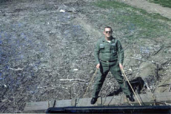
This is me at Vandenberg AFB. We were clearing a
field so that we could release weather balloons. We had to run along
holding the instrument until the balloon was high enough so that the
instrument wouldn’t hit the ground when let go.
I finally went back to Tinker for
good in March 1967 and was separated from active duty in April 1967.While
in the Air Force I reached the rank of what was then called Airman 1st
Class. Now they call it Senior Airman. The pay grade was E4.
|